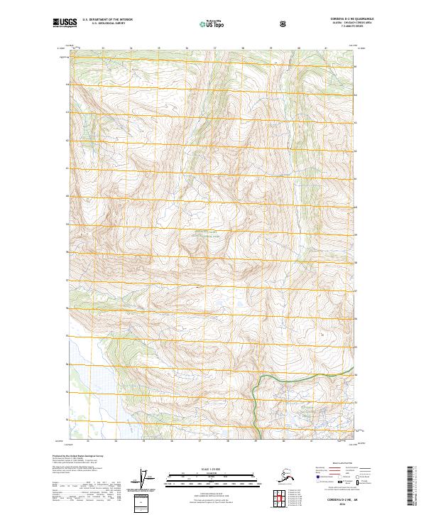
2024 Map of Cordova D-2 NE
USGS Topo · Published 2024About this map
Wrangell-St Elias Wilderness Wrangell-Saint Elias National Park dominates this landscape, showing a preserved expanse of Alaska’s interior before it meets the coastal transition. The terrain is defined by extreme elevation changes and drainage patterns that feed south toward the Bremner River. In the southeastern portion of the map, the boundary of Chugach National Forest intersects with the wilderness area, marking a significant convergence of federal land management zones. This survey provides a baseline of the modern topography, illustrating the complex watershed and remote glacial valleys that have long isolated this region from permanent settlement and industrial development.
Find a feature on this map
7 named features on this map. Tap any name to fly to it.
Don’t see what you’re looking for? This feature index may not catch every label — zoom into the map to look around manually.
Map Details
Editions of this 2024 Cordova D-2 NE Map
This is the sole edition of this map. No revisions or reprints were ever made.
Other maps of this area

1948 · Cordova
USGS Topo · 1:250,000

1951 · Cordova
USGS Topo · 1:250,000

1951 · Valdez A-1
USGS Topo · 1:63,360

1951 · Valdez A-2
USGS Topo · 1:63,360

1952 · Valdez
USGS Topo · 1:250,000
1957 · Valdez A-2
USGS Topo · 1:63,360

1959 · Cordova D-1
USGS Topo · 1:63,360

1959 · Cordova D-2
USGS Topo · 1:63,360

1959 · Cordova
USGS Topo · 1:250,000

1960 · Valdez
USGS Topo · 1:250,000