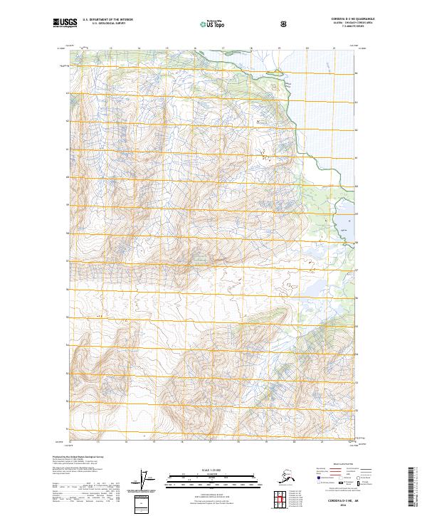
2024 Map of Cordova D-3 NE
USGS Topo · Published 2024About this map
The Copper River corridor dominates the eastern edge of this landscape, where the massive waterway meets the confluence of the Tasnuna River. This terrain is defined by the high, ice-capped ridges and deep valleys of the Chugach National Forest, illustrating a glacial geography where features like Whiting Falls and the winding Ginny Creek drain the steep elevations. The presence of Island Point near the river's edge suggests the dynamic nature of this delta-like environment, where water levels and silt deposits continually reshape the bank. This recent survey provides a precise look at the drainage patterns and topographic relief of this roadless region, emphasizing the scale of the waterway systems that have historically dictated travel and access in this part of Alaska.
Find a feature on this map
10 named features on this map. Tap any name to fly to it.
Don’t see what you’re looking for? This feature index may not catch every label — zoom into the map to look around manually.
Map Details
Editions of this 2024 Cordova D-3 NE Map
This is the sole edition of this map. No revisions or reprints were ever made.
Other maps of this area

1948 · Cordova
USGS Topo · 1:250,000

1950 · Valdez A-3
USGS Topo · 1:63,360

1950 · Cordova D-3
USGS Topo · 1:63,360

1951 · Cordova
USGS Topo · 1:250,000

1951 · Valdez A-2
USGS Topo · 1:63,360

1952 · Valdez
USGS Topo · 1:250,000

1953 · Cordova D-3
USGS Topo · 1:63,360

1953 · Valdez A-3
USGS Topo · 1:63,360
1957 · Valdez A-2
USGS Topo · 1:63,360

1959 · Cordova D-2
USGS Topo · 1:63,360