
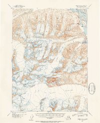
1953 Map of Cordova D-3
USGS Topo · Published 1954About this map
The Copper River winds through the eastern edge of this 1953 survey, providing the primary geographical anchor for a landscape dominated by the massive ice fields of the Chugach Mountains. The settlement of Bremner is positioned near the riverbank, serving as a rare point of human habitation in a region defined by shifting ice and steep elevation. Detailed topographic work from 1950 aerial photography reveals the complex surface of the Schwan Glacier, Heney Glacier, and Allen Glacier, including numerous mapped crevasses that indicate the active movement of these glacial systems.
Find a feature on this map
8 named features on this map. Tap any name to fly to it.
Don’t see what you’re looking for? This feature index may not catch every label — zoom into the map to look around manually.
Map Details
Editions of this 1953 Cordova D-3 Map
2 editions found
Other maps of this area

1948 · Cordova
USGS Topo · 1:250,000

1950 · Valdez A-3
USGS Topo · 1:63,360

1950 · Cordova C-4
USGS Topo · 1:63,360

1950 · Cordova D-3
USGS Topo · 1:63,360

1951 · Cordova
USGS Topo · 1:250,000

1951 · Cordova C-3
USGS Topo · 1:63,360

1951 · Cordova D-4
USGS Topo · 1:63,360

1951 · Valdez A-2
USGS Topo · 1:63,360

1952 · Valdez
USGS Topo · 1:250,000

1953 · Cordova D-4
USGS Topo · 1:63,360