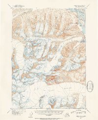
1953 Map of Cordova D-3
USGS Topo · Published 1954About this map
Chugach Mountains peaks and extensive ice fields dominate this mid-century topographic study, where the glacial landscape is defined by the massive Schwan Glacier, Heney Glacier, and Allen Glacier. These frozen rivers flow toward the eastern edge of the map, meeting the corridor of the Copper River. Along the riverbank, the presence of the Old Railroad Grade serves as a reminder of the Copper River and Northwestern Railway, which once connected the interior copper mines to the coast. Near the mouth of Ginny Creek, the small settlement of Bremner and the nearby VABM Low Base 2 mark one of the few points of human activity in this landscape. The map provides a precise record of the numerous Crevasses and topographical contours just before significant environmental shifts in the region.
Find a feature on this map
11 named features on this map. Tap any name to fly to it.
Don’t see what you’re looking for? This feature index may not catch every label — zoom into the map to look around manually.
Map Details
Editions of this 1953 Cordova D-3 Map
2 editions found

Other maps of this area

1948 · Cordova
USGS Topo · 1:250,000

1950 · Valdez A-3
USGS Topo · 1:63,360

1950 · Cordova C-4
USGS Topo · 1:63,360

1950 · Cordova D-3
USGS Topo · 1:63,360

1951 · Cordova
USGS Topo · 1:250,000

1951 · Cordova C-3
USGS Topo · 1:63,360

1951 · Cordova D-4
USGS Topo · 1:63,360

1951 · Valdez A-2
USGS Topo · 1:63,360

1952 · Valdez
USGS Topo · 1:250,000

1953 · Cordova D-4
USGS Topo · 1:63,360