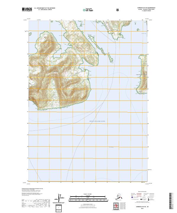
2024 Map of Cordova D-8 SE
USGS Topo · Published 2024About this map
The Alutiiq village of Tatitlek occupies a sheltered coastline along the northeastern reaches of Prince William Sound. This coastal landscape is dominated by the mountainous mass of Bligh Island, separated from the mainland by West Bay. Most local infrastructure, including the Tatitlek Airpor, the Tatitlek Cem, and the Landfill Access Rd, is concentrated around the village center, while the surrounding territory is managed as part of the Chugach National Forest. The map details a complex maritime geography of inlets and peninsulas, ranging from the Copper Mountain Peninsula and Bidarka Point in the east to the deep waters of Port Fidalgo in the south. The intricate shoreline, featuring Cloudman Bay and Boulder Bay, underscores the region's historical and contemporary reliance on water-based travel and subsistence.
Find a feature on this map
21 named features on this map. Tap any name to fly to it.
Don’t see what you’re looking for? This feature index may not catch every label — zoom into the map to look around manually.
Map Details
Editions of this 2024 Cordova D-8 SE Map
This is the sole edition of this map. No revisions or reprints were ever made.
Other maps of this area

1948 · Cordova
USGS Topo · 1:250,000

1950 · Cordova C-7
USGS Topo · 1:63,360

1950 · Cordova D-7
USGS Topo · 1:63,360

1950 · Cordova C-8
USGS Topo · 1:63,360

1951 · Cordova
USGS Topo · 1:250,000

1951 · Cordova D-8
USGS Topo · 1:63,360

1952 · Cordova D-8
USGS Topo · 1:63,360

1952 · Cordova C-8
USGS Topo · 1:63,360

1952 · Cordova D-7
USGS Topo · 1:63,360
1953 · Cordova C-7
USGS Topo · 1:63,360