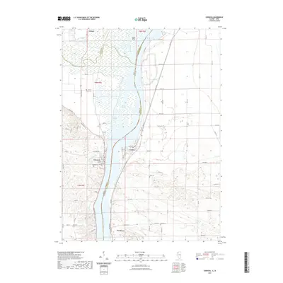
2021 Map of Cordova
USGS Topo · Published 2021About this map
The Mississippi River corridor defines this borderland between Illinois and Iowa, where the river's complex braided channels and side-waters like Cordova Slough and Grant Slough create a diverse riparian landscape. To the north, the Wapsipinicon River joins the main stem near Adams Island, a significant landform within the river's reach. The settlement pattern follows the high ground along the banks, anchored by the river towns of Cordova, Port Byron, and Princeton. Genealogists will find a high density of burial grounds throughout the quadrangle, including Oak Ridge Cem, Princeton City Cem, and the more isolated Baker Cem or Jacks Cem. The map illustrates the contemporary road network, including Bluff Rd and Fairfield Rd, which connect these riverfront communities to the interior agricultural uplands and scattered settlements like Folletts.
Find a feature on this map
87 named features on this map. Tap any name to fly to it.
Don’t see what you’re looking for? This feature index may not catch every label — zoom into the map to look around manually.
Map Details
Editions of this 2021 Cordova Map
This is the sole edition of this map. No revisions or reprints were ever made.
Other maps of this area

1891 · Clinton
USGS Topo · 1:62,500

1892 · Goose Lake
USGS Topo · 1:62,500

1892 · Leclaire
USGS Topo · 1:62,500

1893 · Leclaire
USGS Topo · 1:62,500

1894 · Goose Lake
USGS Topo · 1:62,500

1894 · Clinton
USGS Topo · 1:62,500

1899 · Clinton
USGS Topo · 1:125,000

1949 · Silvis
USGS Topo · 1:24,000

1949 · Port Byron
USGS Topo · 1:24,000

1950 · Port Byron
USGS Topo · 1:24,000