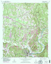
1949 Map of Cordova
USGS Topo · Published 1983About this map
Cordova sits at the heart of this landscape where the Southern and Burlington Northern railroads converge near the banks of the Mulberry Fork. The area's settlement pattern is defined by rural community centers and family landmarks, including Gardiners Gin and Lynns Park, alongside numerous spiritual and educational anchors like Union Chapel and Baltimore Sch. The topography is shaped by the winding course of Blackwater Creek and the deep bends of the Mulberry Fork, such as Barton Bend and Benoit Bend.
Find a feature on this map
55 named features on this map. Tap any name to fly to it.
Don’t see what you’re looking for? This feature index may not catch every label — zoom into the map to look around manually.
Map Details
Editions of this 1949 Cordova Map
4 editions found
Other maps of this area

1893 · Jasper
USGS Topo · 1:125,000

1935 · Port Birmingham
USGS Topo · 1:48,000

1938 · Port Birmingham
USGS Topo · 1:62,500

1949 · Cordova
USGS Topo · 1:24,000

1949 · Parrish
USGS Topo · 1:24,000

1949 · Sipsey
USGS Topo · 1:24,000

1949 · Cold Springs
USGS Topo · 1:24,000

1949 · Jasper
USGS Topo · 1:24,000

1949 · Manchester
USGS Topo · 1:24,000

1949 · Sunlight
USGS Topo · 1:24,000