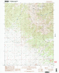
1989 Map of Corey Peak
USGS Topo · Published 1989About this map
Corey Peak and the high summits of the Wassuk Range dominate this late-century survey of Nevada's high desert. The landscape is defined by its industrial and military utility, showing the extensive southern boundary of the Hawthorne Army Ammunition Depot near Big Indian Mountain. In the south, the Toiyabe National Forest hosts significant mineral extraction activity, particularly around the Borealis Mine complex. Here, detailed mapping of a Strip Mine, Mine Shaft, and multiple Tailings piles reveals the footprint of modern mining operations. Transportation through these steep grades is facilitated by 4wd tracks and the notable crossing at Lucky Boy Pass. Drainage patterns from the peaks are traced through narrow corridors like Baldwin Canyon and along Corey Creek, illustrating the intersection of natural topography with the region's resource-driven development.
Find a feature on this map
23 named features on this map. Tap any name to fly to it.
Don’t see what you’re looking for? This feature index may not catch every label — zoom into the map to look around manually.
Map Details
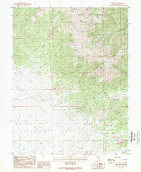
Editions of this 1989 Corey Peak Map
2 editions found
Other maps of this area

1909 · Hawthorne
USGS Topo · 1:250,000

1911 · Hawthorne
USGS Topo · 1:250,000

1915 · Hawthorne
USGS Topo · 1:250,000

1948 · Walker Lake
USGS Topo · 1:250,000

1955 · Powell Mtn
USGS Topo · 1:62,500

1955 · Hawthorne
USGS Topo · 1:62,500

1956 · Mt. Grant
USGS Topo · 1:62,500

1956 · Aurora
USGS Topo · 1:62,500

1957 · Walker Lake
USGS Topo · 1:250,000

1962 · Walker Lake
USGS Topo · 1:250,000