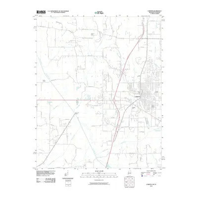
2010 Map of Corinth
USGS Topo · Published 2010About this map
Corinth serves as the focal point of this Mississippi landscape, showing the city's structure just south of the Tennessee border. The map documents a significant concentration of commemorative sites, including the Corinth National Cemetery and the Corinth City Cemetery, reflecting the area's deep ties to regional history. The terrain is defined by the winding course of the Tuscumbia River to the west and a network of creeks such as Cane Creek and Bridge Creek that drain the undulating lands around College Hill.
Find a feature on this map
81 named features on this map. Tap any name to fly to it.
Don’t see what you’re looking for? This feature index may not catch every label — zoom into the map to look around manually.
Map Details
Editions of this 2010 Corinth Map
This is the sole edition of this map. No revisions or reprints were ever made.
Other maps of this area

1935 · Glens
USGS Topo · 1:24,000

1936 · Kendrick
USGS Topo · 1:24,000

1936 · Michie
USGS Topo · 1:24,000

1949 · Michie
USGS Topo · 1:24,000

1950 · Corinth
USGS Topo · 1:62,500

1950 · Kendrick
USGS Topo · 1:24,000

1950 · Glens
USGS Topo · 1:24,000

1951 · Chewalla
USGS Topo · 1:24,000

1951 · Guys
USGS Topo · 1:24,000
1952 · Michie
USGS Topo · 1:24,000