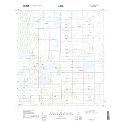
2021 Map of Corkscrew SE
USGS Topo · Published 2021About this map
Orangetree serves as the primary residential hub in this Collier County landscape, where modern suburban development meets the expansive Florida wetlands. The transition from the structured street grids of Orangetree to the surrounding hydrologic features like Corkscrew Swamp and Bird Rookery Swamp illustrates the region's 21st-century growth patterns. Named strands and heads, such as Winchester Strand and Winchester Head, denote the intricate drainage and vegetation corridors that define the terrain. Higher ground is identified as islands, including Big Corkscrew Island and Forth Island, which historically provided dry footing amidst the swamps. The road network, including the prominent Oil Well Grade Rd and several avian-themed thoroughfares like Purple Martin Dr, shows how access has been carved into this formerly remote wilderness.
Find a feature on this map
86 named features on this map. Tap any name to fly to it.
Don’t see what you’re looking for? This feature index may not catch every label — zoom into the map to look around manually.
Map Details
Editions of this 2021 Corkscrew SE Map
This is the sole edition of this map. No revisions or reprints were ever made.
Other maps of this area

1956 · West Palm Beach
USGS Topo · 1:250,000

1957 · West Palm Beach
USGS Topo · 1:250,000

1958 · West Palm Beach
USGS Topo · 1:250,000

1958 · Corkscrew SE
USGS Topo · 1:24,000

1958 · Corkscrew NW
USGS Topo · 1:24,000

1958 · Catherine Island
USGS Topo · 1:24,000

1958 · Immokalee
USGS Topo · 1:24,000

1958 · Belle Meade NE
USGS Topo · 1:24,000

1958 · Belle Meade NW
USGS Topo · 1:24,000

1958 · Immokalee SW
USGS Topo · 1:24,000