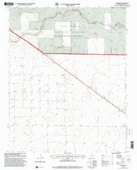
1998 Map of Corlena
USGS Topo · Published 2001About this map
Rita Blanca National Grassland dominates the northern reaches of this Panhandle landscape, where the drainage of West Rita Blanca Creek and Rita Blanca Creek cuts through the high plains. The settlement of Corlena and the nearby label Corena sit along the diagonal corridor of Route 87, illustrating the rural transit patterns that defined Dallam County at the close of the twentieth century. While much of the land remains open range or managed grassland, localized centers of community life are marked by St Marys Ch and a nearby Cem in the southeast. A small Roadside Park provides a dedicated stopping point for travelers along the highway, punctuating an otherwise sparse and expansive topographic sheet focused on water conservation and cattle country.
Find a feature on this map
10 named features on this map. Tap any name to fly to it.
Don’t see what you’re looking for? This feature index may not catch every label — zoom into the map to look around manually.
Map Details
Editions of this 1998 Corlena Map
This is the sole edition of this map. No revisions or reprints were ever made.
Other maps of this area

1954 · Dalhart
USGS Topo · 1:250,000

1958 · Dalhart
USGS Topo · 1:250,000

1962 · Dalhart
USGS Topo · 1:250,000

1970 · Texline South
USGS Topo · 1:24,000

1970 · Texline North
USGS Topo · 1:24,000

1970 · Sedan NE
USGS Topo · 1:24,000

1973 · Buffalo Springs
USGS Topo · 1:24,000

1973 · Wharton Ranch
USGS Topo · 1:24,000

1973 · Corlena
USGS Topo · 1:24,000

1973 · Perico
USGS Topo · 1:24,000