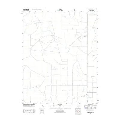
2012 Map of Corlena NW
USGS Topo · Published 2012About this map
E Rita Blanca Cr meanders across this High Plains landscape in Dallam County, defining the drainage patterns of this expansive ranching and agricultural region. The 2012 survey illustrates a classic Panhandle section-line grid, where long, straight roads like Poole Rd and Coulter Rd divide the territory into distinct blocks. In the northeast corner, Coldwater Creek cuts a small path, while the intersection of major rural routes like FM 2586 and FM 296 facilitates movement through the territory. Named family lanes including Ratzlaff Ln, Thompson Grove Ln, and Debbie Rd indicate established homesteads and local landholdings. This map captures the modern spatial organization of the Texas Panhandle, showing the sparse but intentional infrastructure required to manage these large-scale agricultural tracts.
Find a feature on this map
16 named features on this map. Tap any name to fly to it.
Don’t see what you’re looking for? This feature index may not catch every label — zoom into the map to look around manually.
Map Details
Editions of this 2012 Corlena NW Map
This is the sole edition of this map. No revisions or reprints were ever made.
Other maps of this area

1954 · Dalhart
USGS Topo · 1:250,000

1958 · Dalhart
USGS Topo · 1:250,000

1962 · Dalhart
USGS Topo · 1:250,000

1969 · Felt SW
USGS Topo · 1:24,000

1969 · Felt
USGS Topo · 1:24,000

1970 · Texline South
USGS Topo · 1:24,000

1970 · Texline North
USGS Topo · 1:24,000

1972 · Rardin Hill
USGS Topo · 1:24,000

1973 · Buffalo Springs
USGS Topo · 1:24,000

1973 · Corlena
USGS Topo · 1:24,000