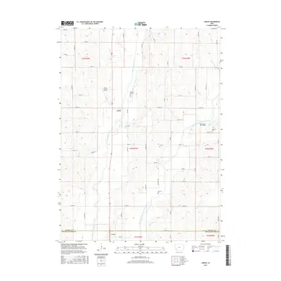
2015 Map of Corley
USGS Topo · Published 2015About this map
The West Nishnabotna River and its East Branch West Nishnabotna River converge in this agricultural region of western Iowa, shaping the local geography across the Shelby and Pottawattamie county line. The settlement of Corley sits at a crossroads in the center of the map, while the northern edge of Avoca appears at the southern boundary. This landscape is a classic example of Iowa's rural grid system, punctuated by family and township landmarks that provide vital clues for local historians and genealogists.
Find a feature on this map
41 named features on this map. Tap any name to fly to it.
Don’t see what you’re looking for? This feature index may not catch every label — zoom into the map to look around manually.
Map Details
Editions of this 2015 Corley Map
This is the sole edition of this map. No revisions or reprints were ever made.
Other maps of this area

1954 · Omaha
USGS Topo · 1:250,000

1957 · Omaha
USGS Topo · 1:250,000

1958 · Omaha
USGS Topo · 1:250,000

1963 · Avoca NW
USGS Topo · 1:24,000

1963 · Avoca
USGS Topo · 1:24,000

1971 · Walnut
USGS Topo · 1:24,000

1978 · Panama
USGS Topo · 1:24,000

1978 · Corley
USGS Topo · 1:24,000

1978 · Prairie Rose Lake
USGS Topo · 1:24,000
1978 · Harlan
USGS Topo · 1:24,000