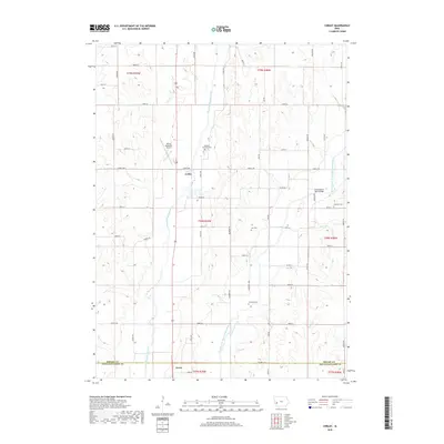
2018 Map of Corley
USGS Topo · Published 2018About this map
The West Nishnabotna River and the East Branch West Nishnabotna River converge in this corner of Shelby County, creating a fertile valley dominated by agricultural grid-lines and rural landmarks. The unincorporated community of Corley sits at the intersection of Street F58 and the river valley, while the town of Avoca anchors the southern boundary at the Pottawattamie County line. This 2018 survey detail provides a modern inventory of the area's spiritual and civic geography, marking several local burial grounds including Fairview Township Cem, Lee Cem, and Jacobson Cem.
Find a feature on this map
46 named features on this map. Tap any name to fly to it.
Don’t see what you’re looking for? This feature index may not catch every label — zoom into the map to look around manually.
Map Details
Editions of this 2018 Corley Map
This is the sole edition of this map. No revisions or reprints were ever made.
Other maps of this area

1954 · Omaha
USGS Topo · 1:250,000

1957 · Omaha
USGS Topo · 1:250,000

1958 · Omaha
USGS Topo · 1:250,000

1963 · Avoca NW
USGS Topo · 1:24,000

1963 · Avoca
USGS Topo · 1:24,000

1971 · Walnut
USGS Topo · 1:24,000

1978 · Panama
USGS Topo · 1:24,000

1978 · Corley
USGS Topo · 1:24,000

1978 · Prairie Rose Lake
USGS Topo · 1:24,000
1978 · Harlan
USGS Topo · 1:24,000