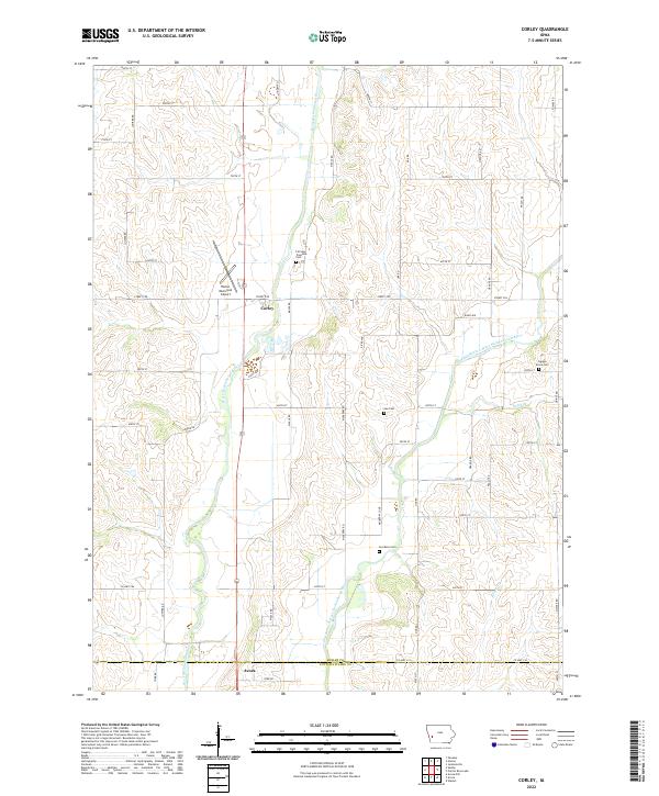
2022 Map of Corley
USGS Topo · Published 2022About this map
Corley sits at the heart of this Western Iowa agricultural landscape, where the valley of the West Nishnabotna River meets its East Branch. The terrain is defined by the winding paths of East Branch West Nishnabotna River and smaller tributaries like Dutch Br and Bedell Cr, which carve through the uplands between the townships. Evidence of early settlement and community history is preserved in several burial grounds, including Fairview Township Cem and Cuppys Grove Cem. To the north, the Harlan Municipal Airport serves the regional hub of Harlan, while the southern edge of the map reaches the outskirts of Avoca. The structured grid of rural roads, such as Co Hwy F66 and Maple Rd, follows the section lines of the Public Land Survey System, illustrating the enduring influence of the original land partitions on modern transport and farming patterns.
Find a feature on this map
45 named features on this map. Tap any name to fly to it.
Don’t see what you’re looking for? This feature index may not catch every label — zoom into the map to look around manually.
Map Details
Editions of this 2022 Corley Map
This is the sole edition of this map. No revisions or reprints were ever made.
Other maps of this area

1954 · Omaha
USGS Topo · 1:250,000

1957 · Omaha
USGS Topo · 1:250,000

1958 · Omaha
USGS Topo · 1:250,000

1963 · Avoca NW
USGS Topo · 1:24,000

1963 · Avoca
USGS Topo · 1:24,000

1971 · Walnut
USGS Topo · 1:24,000

1978 · Panama
USGS Topo · 1:24,000

1978 · Corley
USGS Topo · 1:24,000

1978 · Prairie Rose Lake
USGS Topo · 1:24,000
1978 · Harlan
USGS Topo · 1:24,000