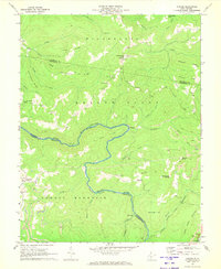
1969 Map of Corliss
USGS Topo · Published 1973About this map
The Meadow River meanders across this landscape, carving a prominent oxbow known as The Loop at the convergence of Nicholas, Greenbrier, and Fayette Counties. The late 1960s industrial character of the region is evident in the numerous strip mines and drill holes dotting the ridges above Hickory Flat and Meadow Bluff. Small communities like Nutterville and Keester are situated along the high ground of Pine Ridge, while the southern reaches are dominated by the elevation of Sewell Mountain. Local life is anchored by landmarks such as the Minnie Bell Ch and Cemetery Hill Ch, along with a Lookout Tower on Sugargrove Knob. This survey captures a moment when resource extraction and rural settlement defined these West Virginia highlands, even as a Roadside Park near Charmee suggests the early influence of regional travel.
Find a feature on this map
46 named features on this map. Tap any name to fly to it.
Don’t see what you’re looking for? This feature index may not catch every label — zoom into the map to look around manually.
Map Details
Editions of this 1969 Corliss Map
2 editions found
Other maps of this area

1887 · Hinton
USGS Topo · 1:125,000

1889 · Nicholas
USGS Topo · 1:125,000

1891 · Nicholas
USGS Topo · 1:125,000

1892 · Hinton
USGS Topo · 1:125,000

1901 · Nicholas
USGS Topo · 1:125,000

1912 · Meadow Creek
USGS Topo · 1:48,000

1914 · Winona
USGS Topo · 1:48,000

1915 · Meadow Creek
USGS Topo · 1:62,500

1916 · Winona
USGS Topo · 1:62,500

1918 · Richwood
USGS Topo · 1:62,500