1952 Map of Corn Creek Springs
USGS Topo · Published 1967About this map
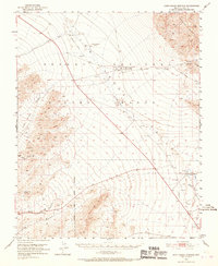
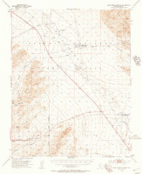
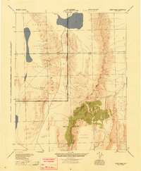
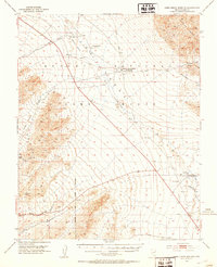
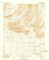
Corn Creek Springs and the expansive Las Vegas Valley define this mid-century survey of the high desert. At the foot of the Sheep Range, the National Fish and Wildlife Service Hdqrs Corn Creek Springs marks a vital water source in an otherwise arid landscape. This area, largely contained within the Desert National Game Range, preserves a snapshot of the region's transport history through the path of a Dismantled Railroad cutting diagonally across the desert floor toward the mountains.
Find a feature on this map
22 named features on this map. Tap any name to fly to it.
Don’t see what you’re looking for? This feature index may not catch every label — zoom into the map to look around manually.
Map Details
Editions of this 1952 Corn Creek Springs Map
3 editions found
Other maps of this area

1907 · Las Vegas
USGS Topo · 1:250,000

1908 · Las Vegas
USGS Topo · 1:250,000

1942 · Indian Spring
USGS Topo · 1:125,000
1945 · Sheep Range
USGS Topo · 1:125,000
1952 · Corn Creek Springs
USGS Topo · 1:62,500
1952 · Gass Peak
USGS Topo · 1:62,500
1952 · Blue Diamond
USGS Topo · 1:62,500

1952 · Las Vegas
USGS Topo · 1:62,500

1954 · Las Vegas
USGS Topo · 1:250,000

1957 · Las Vegas
USGS Topo · 1:250,000