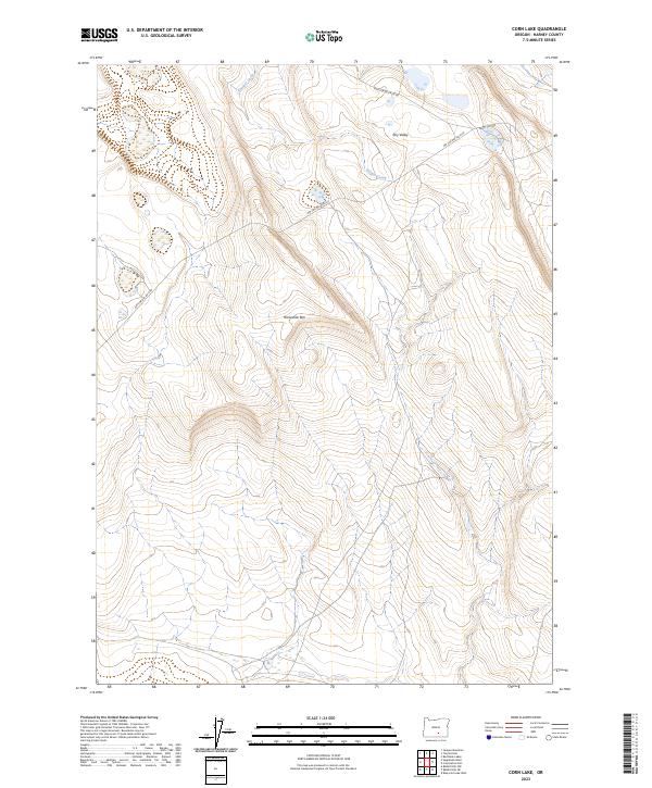
2023 Map of Corn Lake
USGS Topo · Published 2023About this map
Horseshoe Rim dominates the central topography of this high-desert landscape in Harney County. The terrain is defined by the drainage of Juniper Creek as it winds through the northern sections, cutting through a high-elevation plateau marked by the expansive Dry Valley. This 2023 survey illustrates the remote infrastructure of the region, where access is provided primarily by forest development routes like Nat For Dev Rd 6130 and Nat For Dev Rd 6185. The map provides a contemporary look at land management boundaries across the Great Basin landscape, following the intersection of several townships including t31s r25e and t32s r24e. The presence of the aptly named Nasty Flat Rd suggests the challenging nature of the local flats and basins found in this part of southeastern Oregon.
Find a feature on this map
10 named features on this map. Tap any name to fly to it.
Don’t see what you’re looking for? This feature index may not catch every label — zoom into the map to look around manually.
Map Details
Editions of this 2023 Corn Lake Map
This is the sole edition of this map. No revisions or reprints were ever made.
Other maps of this area

1955 · Adel
USGS Topo · 1:250,000

1957 · Adel
USGS Topo · 1:250,000

1958 · Adel
USGS Topo · 1:250,000

1962 · Adel
USGS Topo · 1:250,000

1966 · Rabbit Hills NE
USGS Topo · 1:24,000

1966 · Rabbit Hills NW
USGS Topo · 1:24,000

1967 · Bluejoint Lake West
USGS Topo · 1:24,000
1971 · Corporation Rim
USGS Topo · 1:24,000
1971 · Red Bank Lakes
USGS Topo · 1:24,000
1984 · Turpin Knoll
USGS Topo · 1:24,000