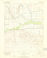
1953 Map of Cornelia
USGS Topo · Published 1954About this map
Las Animas county terrain in the mid-1950s is defined by a sophisticated irrigation and rail network essential to plains agriculture. The Arkansas River serves as the primary artery, flanked by the Fort Lyon Canal, Horse Creek Outlet Ditch, and Consolidated Ditch, which redirect water into the dry surrounding landscape. This engineered environment supported small rural centers and school districts, including the Cornelia School and Horse Creek School, which anchored the local farm families of the era. The presence of the Las Animas State Fish Hatchery and numerous windmills suggests a heavy reliance on managed water resources. Highlighting the region's transport links, the Atchison Topeka and Santa Fe railroad runs parallel to the river, connecting the settlements of Marlman, Riverdale, and Cornelia to larger markets.
Find a feature on this map
22 named features on this map. Tap any name to fly to it.
Don’t see what you’re looking for? This feature index may not catch every label — zoom into the map to look around manually.
Map Details
Editions of this 1953 Cornelia Map
3 editions found
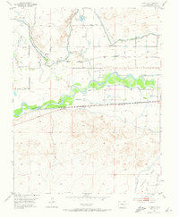
Other maps of this area

1891 · Higbee
USGS Topo · 1:125,000

1891 · Las Animas
USGS Topo · 1:125,000

1893 · Higbee
USGS Topo · 1:125,000

1893 · Las Animas
USGS Topo · 1:125,000

1953 · Las Animas
USGS Topo · 1:24,000

1953 · Cornelia
USGS Topo · 1:24,000

1953 · Hadley
USGS Topo · 1:24,000

1954 · Lamar
USGS Topo · 1:250,000

1955 · Mc Intosh Ranch
USGS Topo · 1:24,000

1955 · Bishop Ranch
USGS Topo · 1:24,000