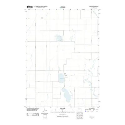
2010 Map of Cornelia
USGS Topo · Published 2010About this map
Lake Cornelia and Elm Lake form a distinct hydrological center in this Wright County landscape, anchoring a rural region defined by its glacial lake basins and the winding course of the Iowa River. The small settlement of Cornelia sits nestled against the eastern shore of its namesake lake, connected to the surrounding countryside by the Cornelia Lake Bridge. Further north, Morse Lake and numerous smaller depressions suggest the poorly drained prairie-pothole heritage of this part of Iowa.
Find a feature on this map
32 named features on this map. Tap any name to fly to it.
Don’t see what you’re looking for? This feature index may not catch every label — zoom into the map to look around manually.
Map Details
Editions of this 2010 Cornelia Map
This is the sole edition of this map. No revisions or reprints were ever made.
Other maps of this area

1954 · Waterloo
USGS Topo · 1:250,000

1955 · Waterloo
USGS Topo · 1:250,000

1972 · Kanawha SE
USGS Topo · 1:24,000

1972 · Cornelia
USGS Topo · 1:24,000

1972 · Kanawha
USGS Topo · 1:24,000

1972 · Olaf
USGS Topo · 1:24,000

1972 · Belmond
USGS Topo · 1:24,000
1972 · Goodell
USGS Topo · 1:24,000

1978 · Holmes
USGS Topo · 1:24,000

1978 · Clarion
USGS Topo · 1:24,000