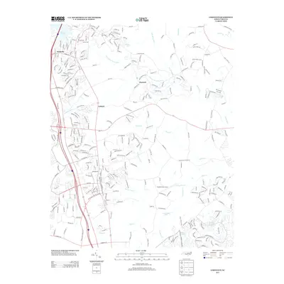
2013 Map of Cornelius
USGS Topo · Published 2013About this map
Lake Norman dominates the northwest corner of this Piedmont landscape, where residential development and aviation infrastructure meet the drainage basins of the Rocky River and Clarke Creek. The map documents the transitioning character of Mecklenburg County, centered on the growing communities of Smithville, Caldwell, and Hopewell. Transportation is a defining feature, with McEver Field and the Bradford Field Airport serving local aviation needs, while a dense network of suburban streets like Jetton St and Concord Rd overlay the historical rural geography. Small water bodies, including Barger Lake, Ferrelltown Lake, and Dream Lake, are scattered throughout the quadrangle, illustrating the modification of local tributaries such as Ferrelltown Creek and Cane Creek. The presence of the Caldwell Station Cr corridor suggests the area's historical rail connections, now serving as a focal point for modern subdivision growth.
Find a feature on this map
293 named features on this map. Tap any name to fly to it.
Don’t see what you’re looking for? This feature index may not catch every label — zoom into the map to look around manually.
Map Details
Editions of this 2013 Cornelius Map
This is the sole edition of this map. No revisions or reprints were ever made.
Other maps of this area

1893 · Statesville
USGS Topo · 1:125,000

1941 · Charlotte
USGS Topo · 1:125,000

1942 · Charlotte
USGS Topo · 1:125,000

1948 · Paw Creek
USGS Topo · 1:24,000

1948 · Derita
USGS Topo · 1:24,000

1949 · Kannapolis
USGS Topo · 1:24,000

1949 · Harrisburg
USGS Topo · 1:24,000

1949 · Hicks Crossroads
USGS Topo · 1:24,000

1953 · Charlotte
USGS Topo · 1:250,000

1954 · Charlotte
USGS Topo · 1:250,000