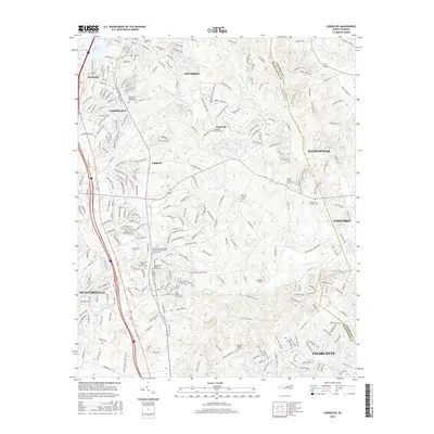
2016 Map of Cornelius
USGS Topo · Published 2016About this map
Davidson Coll serves as a northern anchor for this study of Mecklenburg County, where the historic campus meets the expanding residential corridors of Cornelius and Huntersville. The landscape is defined by the headwaters of the Rocky River and its various forks, including the S Prong W Br Rocky River and S Prong Clark Cr. These drainage patterns influenced early settlement, as evidenced by the high concentration of historic congregational centers and their associated grounds, such as Mount Zion Methodist Church, Ramah Church, and the Huntersville Associate Reformed Presbyterian Church. The Norfolk Southern rail line bisects the area, tracing the old transport spine that connected Smithville and Caldwell to larger hubs. The map captures the suburban density of the 21st century while preserving the locations of smaller family landmarks like the Cashion - Moore Family Cem.
Find a feature on this map
285 named features on this map. Tap any name to fly to it.
Don’t see what you’re looking for? This feature index may not catch every label — zoom into the map to look around manually.
Map Details
Editions of this 2016 Cornelius Map
This is the sole edition of this map. No revisions or reprints were ever made.
Other maps of this area

1893 · Statesville
USGS Topo · 1:125,000

1941 · Charlotte
USGS Topo · 1:125,000

1942 · Charlotte
USGS Topo · 1:125,000

1948 · Paw Creek
USGS Topo · 1:24,000

1948 · Derita
USGS Topo · 1:24,000

1949 · Kannapolis
USGS Topo · 1:24,000

1949 · Harrisburg
USGS Topo · 1:24,000

1949 · Hicks Crossroads
USGS Topo · 1:24,000

1953 · Charlotte
USGS Topo · 1:250,000

1954 · Charlotte
USGS Topo · 1:250,000