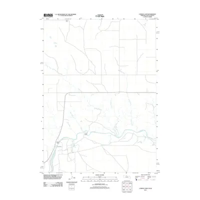
2011 Map of Cornell Dam
USGS Topo · Published 2011About this map
The Niobrara River carves through this landscape, defining the character of the terrain with its winding course and several named tributaries. This 2011 survey reveals a quiet, river-focused geography where water management and crossings are central, anchored by the Cornell Dam and the nearby Cornell Bridge. The presence of Fort Falls and Tyler Falls along the river's path indicates the dramatic shifts in elevation that occur along this waterway.
Find a feature on this map
13 named features on this map. Tap any name to fly to it.
Don’t see what you’re looking for? This feature index may not catch every label — zoom into the map to look around manually.
Map Details
Editions of this 2011 Cornell Dam Map
This is the sole edition of this map. No revisions or reprints were ever made.
Other maps of this area

1950 · Sparks
USGS Topo · 1:62,500

1950 · Valentine
USGS Topo · 1:62,500

1955 · Martin
USGS Topo · 1:250,000

1957 · Valentine
USGS Topo · 1:250,000

1958 · Martin
USGS Topo · 1:250,000

1959 · Valentine
USGS Topo · 1:250,000

1982 · Olsonville SE
USGS Topo · 1:24,000

1982 · Hidden Timber SE
USGS Topo · 1:24,000
1982 · Littleburg
USGS Topo · 1:24,000

1982 · Mission
USGS Topo · 1:100,000