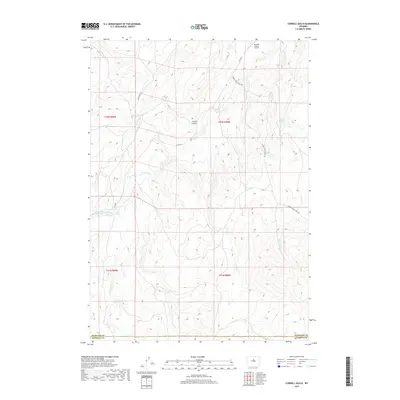
2017 Map of Cornell Gulch
USGS Topo · Published 2017About this map
Cornell Gulch sits at the heart of this high-plains landscape where the Nowood River cuts through the arid terrain of Washakie and Natrona counties. This 2017 topographic record documents a region shaped by ranching and resource management, evidenced by the presence of the Orchard Ranch Airport and the engineered waters of the Orchard Reservoir. The drainage network is clearly defined by seasonal watercourses like Split Rock Creek, Bear Creek, and Lone Tree Creek, which converge toward the river valley.
Find a feature on this map
17 named features on this map. Tap any name to fly to it.
Don’t see what you’re looking for? This feature index may not catch every label — zoom into the map to look around manually.
Map Details
Editions of this 2017 Cornell Gulch Map
This is the sole edition of this map. No revisions or reprints were ever made.
Other maps of this area

1952 · Cottonwood Pass
USGS Topo · 1:24,000

1952 · Sioux Pass
USGS Topo · 1:24,000

1952 · Badwater NE
USGS Topo · 1:24,000

1952 · Battle Mountain
USGS Topo · 1:24,000

1955 · Arminto
USGS Topo · 1:250,000

1958 · Arminto
USGS Topo · 1:250,000

1962 · Arminto
USGS Topo · 1:250,000

1966 · Sand Point
USGS Topo · 1:24,000

1967 · Mahogany Butte
USGS Topo · 1:24,000
1967 · Cornell Gulch
USGS Topo · 1:24,000