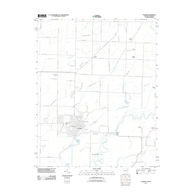
2011 Map of Corning
USGS Topo · Published 2011About this map
The Black River snakes through the southern portion of this region, creating a complex hydrologic landscape defined by Sweet Clover Bend and a network of oxbows and sloughs. Near the convergence of several major drainage projects like Cypress Creek Ditch and Middle Creek Ditch, the city of Corning serves as the primary hub of activity, featuring the Corning Post Office and Corning Cemetery. The terrain is marked by the subtle rise of Moark Ridge to the north, where the small settlement of Moark sits near the state line. This area is notably dense with family and community burial grounds, including Williams Cemetery, Allmandinger Cemetery, and Redenbo Cemetery, providing significant points of interest for those tracing local lineages. The map also captures the managed water systems of the early 21st century, from the Rose Pond Lateral to the serene waters of Victory Lake and Taylor Lake.
Find a feature on this map
63 named features on this map. Tap any name to fly to it.
Don’t see what you’re looking for? This feature index may not catch every label — zoom into the map to look around manually.
Map Details
Editions of this 2011 Corning Map
This is the sole edition of this map. No revisions or reprints were ever made.
Other maps of this area

1935 · Acorn
USGS Topo · 1:62,500

1935 · Rector
USGS Topo · 1:62,500

1935 · Knobel
USGS Topo · 1:62,500

1935 · Harviell
USGS Topo · 1:62,500

1940 · Naylor
USGS Topo · 1:62,500

1941 · Knobel
USGS Topo · 1:62,500

1944 · Naylor
USGS Topo · 1:62,500

1957 · Poplar Bluff
USGS Topo · 1:250,000

1958 · Rector
USGS Topo · 1:62,500

1959 · Poplar Bluff
USGS Topo · 1:250,000