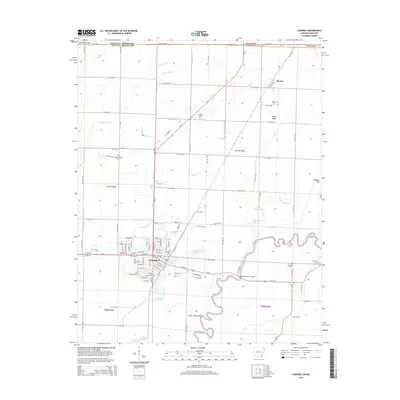
2014 Map of Corning
USGS Topo · Published 2014About this map
Corning anchors this landscape in Clay County, Arkansas, showing the developed town grid and its surrounding agricultural drainage network as it appeared in the early 2010s. The geography is defined by the winding course of the Black River, which creates complex hydrological features like Sweet Clover Bend and Winding Slough. To the north, the smaller settlement of Moark sits near the Missouri state line, framed by Moark Ridge and the Moark Ditch. This area is a patchwork of engineered waterways, including the Byrnes Ditch and Rose Pond Lateral, which illustrate the intensive efforts to manage the low-lying terrain for cultivation. For those researching family history, the map identifies several local burial grounds, including Allmandinger Cem and Redenbo Cem, alongside notable landmarks like the Bennetts Ferry Bridge and Victory Lake.
Find a feature on this map
123 named features on this map. Tap any name to fly to it.
Don’t see what you’re looking for? This feature index may not catch every label — zoom into the map to look around manually.
Map Details
Editions of this 2014 Corning Map
This is the sole edition of this map. No revisions or reprints were ever made.
Other maps of this area

1935 · Acorn
USGS Topo · 1:62,500

1935 · Rector
USGS Topo · 1:62,500

1935 · Knobel
USGS Topo · 1:62,500

1935 · Harviell
USGS Topo · 1:62,500

1940 · Naylor
USGS Topo · 1:62,500

1941 · Knobel
USGS Topo · 1:62,500

1944 · Naylor
USGS Topo · 1:62,500

1957 · Poplar Bluff
USGS Topo · 1:250,000

1958 · Rector
USGS Topo · 1:62,500

1959 · Poplar Bluff
USGS Topo · 1:250,000