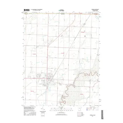
2017 Map of Corning
USGS Topo · Published 2017About this map
The Black River meanders through this section of Clay County, defining a landscape of complex wetlands and agricultural drainage networks. The city of Corning serves as the primary hub, where a grid of residential streets like Columbia St and W Hazel St meets the industrial and transport corridors. The area's history is preserved in numerous burial grounds, including the centrally located Corning Cem and the more remote Williams Cem.
Find a feature on this map
79 named features on this map. Tap any name to fly to it.
Don’t see what you’re looking for? This feature index may not catch every label — zoom into the map to look around manually.
Map Details
Editions of this 2017 Corning Map
This is the sole edition of this map. No revisions or reprints were ever made.
Other maps of this area

1935 · Acorn
USGS Topo · 1:62,500

1935 · Rector
USGS Topo · 1:62,500

1935 · Knobel
USGS Topo · 1:62,500

1935 · Harviell
USGS Topo · 1:62,500

1940 · Naylor
USGS Topo · 1:62,500

1941 · Knobel
USGS Topo · 1:62,500

1944 · Naylor
USGS Topo · 1:62,500

1957 · Poplar Bluff
USGS Topo · 1:250,000

1958 · Rector
USGS Topo · 1:62,500

1959 · Poplar Bluff
USGS Topo · 1:250,000