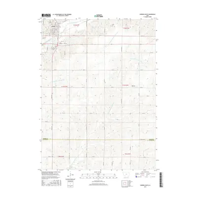
2015 Map of Corning South
USGS Topo · Published 2015About this map
Corning serves as the primary hub at the northern edge of this landscape, where the E Nodaway River cuts through the terrain. The map details a rural geography defined by the branching waterways of the One Hundred and Two River system, including the W Fork One Hundred and Two River and the W Br One Hundred and Two River. Small settlements and landmarks dot the countryside, such as the community of Mercer and a concentration of burial sites near the main town. These include Walnut Grove Cem, Calvary Cem, and Oak Hill Cem, which offer significant genealogical data for the region. Farther east, the Icarian Cem stands as a notable historical marker of the area's communal heritage. The southern half of the sheet transitions across the Adams Co Taylor Co line, showing the intricate network of county roads like Co RD h54 that connect the isolated farmsteads and tributary creeks like Willow Cr and Rose Br.
Find a feature on this map
44 named features on this map. Tap any name to fly to it.
Don’t see what you’re looking for? This feature index may not catch every label — zoom into the map to look around manually.
Map Details
Editions of this 2015 Corning South Map
This is the sole edition of this map. No revisions or reprints were ever made.
Other maps of this area

1954 · Omaha
USGS Topo · 1:250,000

1955 · Nebraska City
USGS Topo · 1:250,000

1957 · Nebraska City
USGS Topo · 1:250,000

1957 · Omaha
USGS Topo · 1:250,000

1958 · Omaha
USGS Topo · 1:250,000

1958 · Nebraska City
USGS Topo · 1:250,000

1980 · Corning South
USGS Topo · 1:24,000

1980 · Gravity
USGS Topo · 1:24,000

1980 · Merle Junction
USGS Topo · 1:24,000

1980 · Lenox
USGS Topo · 1:24,000