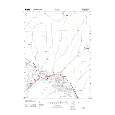
2013 Map of Corning
USGS Topo · Published 2013About this map
The Conhocton River and Tioga River converge to form the Chemung River in this detailed 2013 survey of the Corning area. This hydrographic junction defines the settlement patterns of Painted Post, Riverside, and Gang Mills, where the valley floor provides a broad stage for transportation and commerce. Genealogists will find several significant burial sites, including the Hope Cem and its Hope Cem Annex near the southern bend of the river, along with the Fairview Cem and High Street Cem in the hills above. The map also records key infrastructure such as the Corning-Painted Post Airport and the Memorial Stadium, while the northern uplands around Hornby and Dyke remain characterized by deep hollows like Erwin Hollow and named peaks like Pine Hill.
Find a feature on this map
171 named features on this map. Tap any name to fly to it.
Don’t see what you’re looking for? This feature index may not catch every label — zoom into the map to look around manually.
Map Details
Editions of this 2013 Corning Map
This is the sole edition of this map. No revisions or reprints were ever made.
Other maps of this area

1895 · Elmira
USGS Topo · 1:62,500

1898 · Watkins Glen
USGS Topo · 1:62,500

1901 · Watkins
USGS Topo · 1:62,500

1903 · Hammondsport
USGS Topo · 1:62,500

1905 · Watkins Glen
USGS Topo · 1:125,000

1914 · Corning
USGS Topo · 1:62,500

1944 · Corning
USGS Topo · 1:62,500

1950 · Elmira
USGS Topo · 1:250,000

1953 · Campbell
USGS Topo · 1:24,000

1953 · Bradford
USGS Topo · 1:24,000