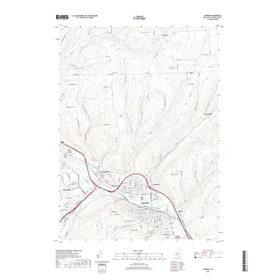
2019 Map of Corning
USGS Topo · Published 2019About this map
The Chemung River serves as the focal point of this region, formed by the confluence of the Cohocton River and Tioga River near the historic industrial center of Corning. The river valley acts as a natural corridor for development, connecting the city to surrounding settlements like Riverside, Painted Post, and South Corning. The topography is defined by high elevations such as Spencer Hill and Higman Hill that overlook the urban core, while more isolated locales like Hornby and Ferenbaugh sit among the upland drainages of Dry Run and Post Creek. Genealogists will find a high density of burial sites across the landscape, including Hope Cem, West Hill Cem, and the Saint Marys Roman Catholic Cem. The map also captures critical infrastructure like the Bridge Street Bridge and the Corning-Painted Post Airport, illustrating how the valley's geography has shaped transportation and settlement patterns into the 21st century.
Find a feature on this map
110 named features on this map. Tap any name to fly to it.
Don’t see what you’re looking for? This feature index may not catch every label — zoom into the map to look around manually.
Map Details
Editions of this 2019 Corning Map
This is the sole edition of this map. No revisions or reprints were ever made.
Other maps of this area

1895 · Elmira
USGS Topo · 1:62,500

1898 · Watkins Glen
USGS Topo · 1:62,500

1901 · Watkins
USGS Topo · 1:62,500

1903 · Hammondsport
USGS Topo · 1:62,500

1905 · Watkins Glen
USGS Topo · 1:125,000

1914 · Corning
USGS Topo · 1:62,500

1944 · Corning
USGS Topo · 1:62,500

1950 · Elmira
USGS Topo · 1:250,000

1953 · Campbell
USGS Topo · 1:24,000

1953 · Bradford
USGS Topo · 1:24,000