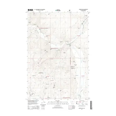
2014 Map of Cornish Gulch
USGS Topo · Published 2014About this map
Deerlodge National Forest defines this high-country terrain in Granite County, where steep drainage patterns are etched into the landscape by Rock Creek and its many tributaries. The area is characterized by numerous named gulches and high points that reflect a history of mineral exploration and mountain navigation, including Sapphire Gulch, Bi-Metalic Gulch, and the prominent Ram Mtn.
Find a feature on this map
55 named features on this map. Tap any name to fly to it.
Don’t see what you’re looking for? This feature index may not catch every label — zoom into the map to look around manually.
Map Details
Editions of this 2014 Cornish Gulch Map
This is the sole edition of this map. No revisions or reprints were ever made.
Other maps of this area

1908 · Philipsburg
USGS Topo · 1:125,000

1909 · Sapphire
USGS Topo · 1:125,000

1947 · Butte
USGS Topo · 1:250,000

1958 · Butte
USGS Topo · 1:250,000

1960 · Butte
USGS Topo · 1:250,000

1962 · Butte
USGS Topo · 1:250,000

1971 · Antelope Creek
USGS Topo · 1:24,000

1971 · Potato Lakes
USGS Topo · 1:24,000
1971 · Black Pine Ridge
USGS Topo · 1:24,000

1971 · Stony Creek
USGS Topo · 1:24,000