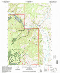
1996 Map of Cornish Gulch
USGS Topo · Published 1998About this map
The Sapphire Mountains dominate this 1990s landscape within the Deerlodge National Forest. This region is defined by an intricate network of drainages and canyons, where Rock Creek and Stony Creek serve as primary watercourses. The presence of the Silver King Mine and numerous unnamed Prospects throughout the gulches point to the area's legacy of mineral exploration. High points like Ram Mountain and the distinctive Squaw Rock overlook a terrain marked by deep ravines such as Cornish Gulch and Windlass Gulch. Human presence is concentrated around specific access points like Gillies Bridge and the Squaw Fork Rental Cabin, which sit at the intersection of forest roads and traditional creek crossings. This survey captures the Forest Service's management of the timber and mineral resources at the close of the twentieth century.
Find a feature on this map
43 named features on this map. Tap any name to fly to it.
Don’t see what you’re looking for? This feature index may not catch every label — zoom into the map to look around manually.
Map Details
Editions of this 1996 Cornish Gulch Map
This is the sole edition of this map. No revisions or reprints were ever made.
Other maps of this area

1908 · Philipsburg
USGS Topo · 1:125,000

1909 · Sapphire
USGS Topo · 1:125,000

1947 · Butte
USGS Topo · 1:250,000

1958 · Butte
USGS Topo · 1:250,000

1960 · Butte
USGS Topo · 1:250,000

1962 · Butte
USGS Topo · 1:250,000

1971 · Antelope Creek
USGS Topo · 1:24,000

1971 · Potato Lakes
USGS Topo · 1:24,000
1971 · Black Pine Ridge
USGS Topo · 1:24,000

1971 · Stony Creek
USGS Topo · 1:24,000