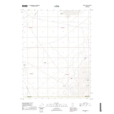
2018 Map of Cornish Peak
USGS Topo · Published 2018About this map
Stillwater Range dominates the eastern landscape of this Nevada survey, rising sharply from the desert floor to its namesake Cornish Peak. This high-elevation terrain is cut by several steep drainages including Cornish Canyon, Hughes Canyon, and New York Canyon. To the west, the landscape flattens into the wide basins of Buena Vista Valley and Antelope Valley, separated by the distinct protrusion of Chocolate Butte. Historical transit corridors define the valley floors, most notably the Old Emigrant Rd in the north and the Coal Canyon-Stillwater Rd in the south. The map also delineates the high-desert border between Pershing and Churchill counties, providing a clear record of the intersection between topographical barriers and political boundaries in the Great Basin.
Find a feature on this map
16 named features on this map. Tap any name to fly to it.
Don’t see what you’re looking for? This feature index may not catch every label — zoom into the map to look around manually.
Map Details
Editions of this 2018 Cornish Peak Map
This is the sole edition of this map. No revisions or reprints were ever made.
Other maps of this area

1908 · Carson Sink
USGS Topo · 1:250,000

1910 · Carson Sink
USGS Topo · 1:250,000

1931 · Lovelock
USGS Topo · 1:250,000

1932 · Sonoma Range
USGS Topo · 1:250,000

1935 · Lovelock
USGS Topo · 1:250,000

1939 · Sonoma Range
USGS Topo · 1:250,000

1954 · Buffalo Mtn
USGS Topo · 1:62,500

1955 · Millett
USGS Topo · 1:250,000

1955 · Lovelock
USGS Topo · 1:250,000

1955 · Winnemucca
USGS Topo · 1:250,000