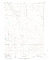
1972 Map of Cornish
USGS Topo · Published 1975About this map
Cornish sits at the southern edge of this Weld County landscape, where the confluence of Crow Creek and Coal Creek defines the local topography. The area is characterized by a network of drainage systems and early water management infrastructure, most notably the Greeley No 2 Ditch snaking across the southwestern corner. This 1970s survey illustrates a region dominated by ranching and agricultural operations, with family-named landmarks like Anderson and Wilson indicating established landholdings and small rural clusters.
Find a feature on this map
12 named features on this map. Tap any name to fly to it.
Don’t see what you’re looking for? This feature index may not catch every label — zoom into the map to look around manually.
Map Details
Editions of this 1972 Cornish Map
3 editions found
Other maps of this area

1902 · Greeley
USGS Topo · 1:125,000

1908 · Eaton
USGS Topo · 1:125,000

1910 · Eaton
USGS Topo · 1:125,000

1950 · Kersey
USGS Topo · 1:24,000

1950 · Barnesville
USGS Topo · 1:24,000

1951 · Point Of Rocks
USGS Topo · 1:24,000

1954 · Greeley
USGS Topo · 1:250,000

1957 · Greeley
USGS Topo · 1:250,000

1958 · Greeley
USGS Topo · 1:250,000

1960 · Purcell
USGS Topo · 1:24,000