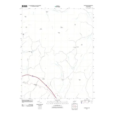
2011 Map of Cornstalk
USGS Topo · Published 2011About this map
Clintonville and the small settlements of Kieffer and Cornstalk anchor this rural Greenbrier County landscape, where the ridge-and-valley topography of West Virginia dictates the placement of early mountain roads. The presence of three distinct mail hubs, including the Clintonville Post Office, Kieffer Post Office, and Cornstalk Post Office, reflects a legacy of localized community centers serving scattered farmsteads and hollows. High ground is defined by prominent landforms such as Meadow Mountain, Cross Mountain, and Buffalo Mountain, which separate the various drainage basins.
Find a feature on this map
58 named features on this map. Tap any name to fly to it.
Don’t see what you’re looking for? This feature index may not catch every label — zoom into the map to look around manually.
Map Details
Editions of this 2011 Cornstalk Map
This is the sole edition of this map. No revisions or reprints were ever made.
Other maps of this area

1887 · Hinton
USGS Topo · 1:125,000

1887 · Lewisburg
USGS Topo · 1:125,000

1889 · Nicholas
USGS Topo · 1:125,000

1891 · Lewisburg
USGS Topo · 1:125,000

1891 · Nicholas
USGS Topo · 1:125,000

1891 · Huntersville
USGS Topo · 1:125,000

1892 · Hinton
USGS Topo · 1:125,000

1894 · Huntersville
USGS Topo · 1:125,000

1901 · Nicholas
USGS Topo · 1:125,000

1918 · Richwood
USGS Topo · 1:62,500