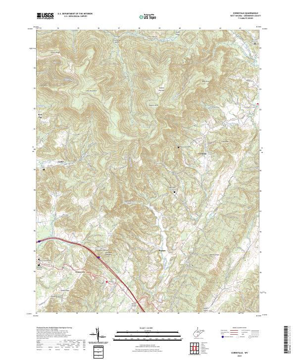
2023 Map of Cornstalk
USGS Topo · Published 2023About this map
Clintonville and the namesake community of Cornstalk anchor this high-elevation terrain in Greenbrier County. The landscape is defined by its deep ridges and narrow creek bottoms, where small settlements like Kieffer and Hughart are tucked along winding roads like the Midland Trl W. A notable concentration of rural burial grounds, including the New Bethel Church Cem and the evocatively named At the End of the Trail Cem, provides a detailed record of local families and congregations. Notable physical features such as Meadow Mountain, Buffalo Mountain, and the marshy Kuhn Glades north of Sinking Creek dictate the settlement patterns of the region. The map reveals how local infrastructure follows the hydrology, with roads frequently paralleling Hughart Creek and Laurel Creek to navigate the steep gaps between Hickory Ridge and Judy Ridge.
Find a feature on this map
81 named features on this map. Tap any name to fly to it.
Don’t see what you’re looking for? This feature index may not catch every label — zoom into the map to look around manually.
Map Details
Editions of this 2023 Cornstalk Map
This is the sole edition of this map. No revisions or reprints were ever made.
Other maps of this area

1887 · Hinton
USGS Topo · 1:125,000

1887 · Lewisburg
USGS Topo · 1:125,000

1889 · Nicholas
USGS Topo · 1:125,000

1891 · Lewisburg
USGS Topo · 1:125,000

1891 · Nicholas
USGS Topo · 1:125,000

1891 · Huntersville
USGS Topo · 1:125,000

1892 · Hinton
USGS Topo · 1:125,000

1894 · Huntersville
USGS Topo · 1:125,000

1901 · Nicholas
USGS Topo · 1:125,000

1918 · Richwood
USGS Topo · 1:62,500