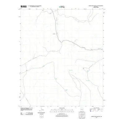
2010 Map of Cornucopia Ranch SE
USGS Topo · Published 2010About this map
Runyan Line Shack stands as a focal point of human presence in this arid reach of Otero County, where life and labor are dictated by the scarce presence of water. The landscape is defined by the branching ephemeral drainages of Lucky Draw and Cornucopia Draw, which serve as the primary topographical markers.
Find a feature on this map
16 named features on this map. Tap any name to fly to it.
Don’t see what you’re looking for? This feature index may not catch every label — zoom into the map to look around manually.
Map Details
Editions of this 2010 Cornucopia Ranch SE Map
This is the sole edition of this map. No revisions or reprints were ever made.
Other maps of this area

1954 · Carlsbad
USGS Topo · 1:250,000

1958 · Carlsbad
USGS Topo · 1:250,000

1963 · Hackberry Hill
USGS Topo · 1:24,000
1963 · Cornucopia Ranch SE
USGS Topo · 1:24,000

1963 · Tanner Ranch
USGS Topo · 1:24,000

1963 · Indian Draw
USGS Topo · 1:24,000

1963 · Cleones Tank
USGS Topo · 1:24,000

1969 · Lewis Canyon
USGS Topo · 1:24,000

1970 · Shiloh Hills
USGS Topo · 1:24,000
1970 · Van Winkle Lake
USGS Topo · 1:24,000