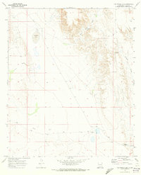
1970 Map of Van Winkle Lake
USGS Topo · Published 1973About this map
Van Winkle Lake and the surrounding drainage basins of Otero County define this high desert landscape, captured during a 1970 field check. The geography is shaped by a network of seasonal watercourses, including Shiloh Draw, Coffelt Draw, and Smith Draw, which cut through the arid terrain. Ranching infrastructure is central to the area's layout, with the Brownfield Ranch and Snow Ranch serving as primary landmarks for local history and genealogy research. Water management for livestock is evident through the presence of named catchments like the Jack Smith Tank and the CCC Tank, the latter suggesting New Deal-era conservation work in the region. The map also detail the elevation changes around Brownfield Hill and the winding path of Boardwell Canyon, providing a clear view of the land use patterns and essential water sources required for life in this part of New Mexico.
Find a feature on this map
14 named features on this map. Tap any name to fly to it.
Don’t see what you’re looking for? This feature index may not catch every label — zoom into the map to look around manually.
Map Details
Editions of this 1970 Van Winkle Lake Map
2 editions found
Other maps of this area

1954 · Carlsbad
USGS Topo · 1:250,000

1958 · Carlsbad
USGS Topo · 1:250,000

1963 · Hackberry Hill
USGS Topo · 1:24,000
1963 · Cornucopia Ranch SE
USGS Topo · 1:24,000

1963 · Cleones Tank
USGS Topo · 1:24,000

1969 · Lewis Canyon
USGS Topo · 1:24,000
1969 · Culp Draw
USGS Topo · 1:24,000
1970 · Shiloh Hills SE
USGS Topo · 1:24,000
1970 · Mc Veigh Hills
USGS Topo · 1:24,000

1970 · Shiloh Hills
USGS Topo · 1:24,000