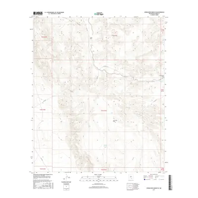
2017 Map of Cornucopia Ranch SE
USGS Topo · Published 2017About this map
Lucky Draw and Cornucopia Draw cut through this arid landscape in southeastern Otero County, defining the drainage patterns of a region dominated by ranching infrastructure. The prevalence of water management features, including West Tanks and Double Tank, indicates the vital role of artificial catchment for livestock in this environment. Historical land divisions are clearly marked by township and range lines, such as t23s r16e, which organize the territory. Transportation is limited to a network of county roads including Co RD e038 and Co RD e028, which follow the natural contours of the terrain. Named landmarks like Jack Smith Draw provide specific points of reference for local historians and researchers tracing the development of land use in this part of New Mexico during the early twenty-first century.
Find a feature on this map
23 named features on this map. Tap any name to fly to it.
Don’t see what you’re looking for? This feature index may not catch every label — zoom into the map to look around manually.
Map Details
Editions of this 2017 Cornucopia Ranch SE Map
This is the sole edition of this map. No revisions or reprints were ever made.
Other maps of this area

1954 · Carlsbad
USGS Topo · 1:250,000

1958 · Carlsbad
USGS Topo · 1:250,000

1963 · Hackberry Hill
USGS Topo · 1:24,000
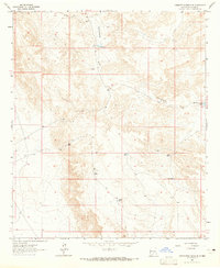
1963 · Cornucopia Ranch SE
USGS Topo · 1:24,000

1963 · Tanner Ranch
USGS Topo · 1:24,000

1963 · Indian Draw
USGS Topo · 1:24,000

1963 · Cleones Tank
USGS Topo · 1:24,000

1969 · Lewis Canyon
USGS Topo · 1:24,000

1970 · Shiloh Hills
USGS Topo · 1:24,000
1970 · Van Winkle Lake
USGS Topo · 1:24,000