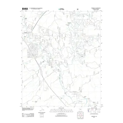
2012 Map of Cornville
USGS Topo · Published 2012About this map
The Verde River and Oak Cr converge in this high-desert landscape, where agricultural water management defines the settlement patterns. Traditional irrigation is evident through the winding paths of the Cornville Ditch, Cottonwood Ditch, and OK Ditch, which support small communities and ranching operations. The confluence area includes established locales like Bridgeport and Verde, while smaller settlements such as Bignotti and Jordan sit along the riparian corridors. Cultural landmarks like the Middle Verde Indian Cem and the Cloverleaf Ranch provide evidence of diverse land use and historical heritage in this Yavapai County region. Rising above the river valleys, the terrain is marked by prominent features like Sheepshead Mountain and Sugarloaf, separated by deep cuts such as Black Canyon and Wilbur Canyon. Transportation networks like Old Hwy 279 and the Verde Santa Fe Pkwy connect these canyon-side communities to the broader region.
Find a feature on this map
31 named features on this map. Tap any name to fly to it.
Don’t see what you’re looking for? This feature index may not catch every label — zoom into the map to look around manually.
Map Details
Editions of this 2012 Cornville Map
This is the sole edition of this map. No revisions or reprints were ever made.
Other maps of this area

1887 · Verde
USGS Topo · 1:250,000

1887 · Prescott
USGS Topo · 1:250,000

1892 · Verde
USGS Topo · 1:250,000

1892 · Prescott
USGS Topo · 1:250,000

1905 · Jerome
USGS Topo · 1:125,000

1923 · Camp Verde
USGS Topo · 1:125,000

1932 · Camp Verde
USGS Topo · 1:125,000

1936 · Camp Verde
USGS Topo · 1:125,000

1944 · Clarkdale
USGS Topo · 1:48,000

1944 · Mingus Mountain
USGS Topo · 1:62,500