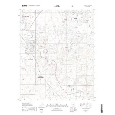
2018 Map of Cornville
USGS Topo · Published 2018About this map
The Verde River and Oak Creek define this landscape south of Sedona, where the legacy of early Arizona industry and settlement is traced through names like Smelter City and Bridgeport. In the early 21st century, these river valleys remain centers of life, evidenced by the intricate network of irrigation channels including the Cornville Ditch, Cottonwood Ditch, and Ok Ditch. These waterways support the communities of Verde Village and Cornville, while the southern portion of the sheet reaches into Camp Verde. Notable cultural landmarks such as the Middle Verde Yavapai Apache Cem provide significant genealogical and tribal context near the Verde River. The terrain transitions from the elevations of Sheepshead Mtn and the White Hills down into numerous desert drainages like Grandpa Wash and Hayfield Draw, illustrating the complex topography between the Coconino National Forest and Prescott National Forest.
Find a feature on this map
115 named features on this map. Tap any name to fly to it.
Don’t see what you’re looking for? This feature index may not catch every label — zoom into the map to look around manually.
Map Details
Editions of this 2018 Cornville Map
This is the sole edition of this map. No revisions or reprints were ever made.
Other maps of this area

1887 · Verde
USGS Topo · 1:250,000

1887 · Prescott
USGS Topo · 1:250,000

1892 · Verde
USGS Topo · 1:250,000

1892 · Prescott
USGS Topo · 1:250,000

1905 · Jerome
USGS Topo · 1:125,000

1923 · Camp Verde
USGS Topo · 1:125,000

1932 · Camp Verde
USGS Topo · 1:125,000

1936 · Camp Verde
USGS Topo · 1:125,000

1944 · Clarkdale
USGS Topo · 1:48,000

1944 · Mingus Mountain
USGS Topo · 1:62,500