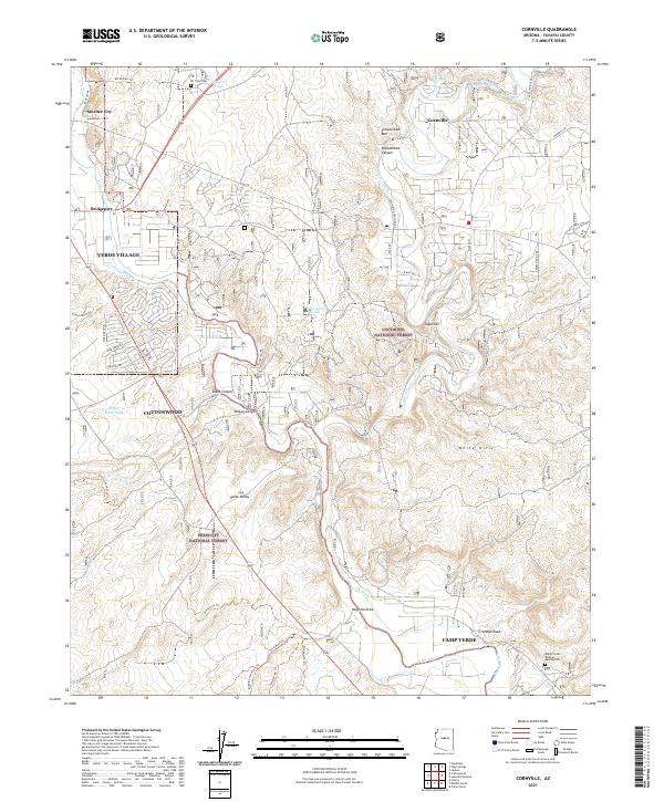
2021 Map of Cornville
USGS Topo · Published 2021About this map
The Verde River corridor serves as the primary artery for settlement and agricultural development in this corner of Yavapai County. The mapping reveals a complex network of water management features essential to the region, including the Cottonwood Ditch, Cornville Ditch, and Ok Ditch, which redirect water toward valley floor communities. This 2021 update shows the footprint of Cottonwood and Verde Village alongside smaller hubs like Bridgeport and Cornville.
Find a feature on this map
57 named features on this map. Tap any name to fly to it.
Don’t see what you’re looking for? This feature index may not catch every label — zoom into the map to look around manually.
Map Details
Editions of this 2021 Cornville Map
This is the sole edition of this map. No revisions or reprints were ever made.
Other maps of this area

1887 · Verde
USGS Topo · 1:250,000

1887 · Prescott
USGS Topo · 1:250,000

1892 · Verde
USGS Topo · 1:250,000

1892 · Prescott
USGS Topo · 1:250,000

1905 · Jerome
USGS Topo · 1:125,000

1923 · Camp Verde
USGS Topo · 1:125,000

1932 · Camp Verde
USGS Topo · 1:125,000

1936 · Camp Verde
USGS Topo · 1:125,000

1944 · Clarkdale
USGS Topo · 1:48,000

1944 · Mingus Mountain
USGS Topo · 1:62,500