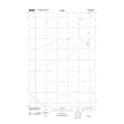
2012 Map of Corona
USGS Topo · Published 2012About this map
Corona serves as the primary settlement hub in this northeastern South Dakota landscape, situated along the northeastern edge of the quadrangle. The town's layout is defined by a grid including Main St, 1st St, and 4th St, where a local Po indicates its role as a regional service point. The surrounding Roberts County countryside is strictly organized by a section-line road network, with numbered routes like 139th St and 472nd Ave partitioning the agricultural land into precise blocks.
Find a feature on this map
22 named features on this map. Tap any name to fly to it.
Don’t see what you’re looking for? This feature index may not catch every label — zoom into the map to look around manually.
Map Details
Editions of this 2012 Corona Map
This is the sole edition of this map. No revisions or reprints were ever made.
Other maps of this area

1953 · Milbank
USGS Topo · 1:250,000

1954 · Big Stone Lake
USGS Topo · 1:62,500

1958 · Milbank
USGS Topo · 1:250,000

1970 · Marvin
USGS Topo · 1:24,000

1970 · Wilmot NW
USGS Topo · 1:24,000

1971 · Corona
USGS Topo · 1:24,000

1971 · Big Stone Lake West
USGS Topo · 1:24,000

1971 · Big Stone Lake SW
USGS Topo · 1:24,000
1971 · Wilmot
USGS Topo · 1:24,000

1973 · Twin Brooks
USGS Topo · 1:24,000