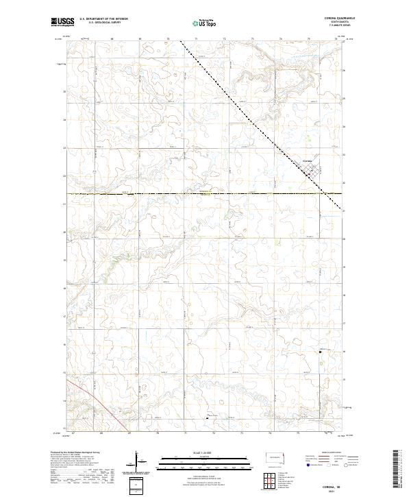
2021 Map of Corona
USGS Topo · Published 2021About this map
The settlement of Corona sits at the intersection of Railroad Ave, Main St, and 1st St, serving as a focal point for this rural corner of Northeast South Dakota. Located near the border of Roberts Co and Grant Co, the town's layout reflects a classic Midwestern rail-aligned orientation. The surrounding landscape is defined by the wandering path of the N Fork Whetstone River in the north and an extensive grid of section roads including Co Rd 11 and 472nd Ave. Genealogy researchers will find specific interest in the outlying Kilborn 1 Cem and Kilborn 3 Cem, which mark the historical burial sites for the surrounding townships. The map details a transition from the structured town center, complete with its Po (Post Office), to the broad agricultural expanses of t122n r49w and t121n r49w.
Find a feature on this map
31 named features on this map. Tap any name to fly to it.
Don’t see what you’re looking for? This feature index may not catch every label — zoom into the map to look around manually.
Map Details
Editions of this 2021 Corona Map
This is the sole edition of this map. No revisions or reprints were ever made.
Other maps of this area

1953 · Milbank
USGS Topo · 1:250,000

1954 · Big Stone Lake
USGS Topo · 1:62,500

1958 · Milbank
USGS Topo · 1:250,000

1970 · Marvin
USGS Topo · 1:24,000

1970 · Wilmot NW
USGS Topo · 1:24,000

1971 · Corona
USGS Topo · 1:24,000

1971 · Big Stone Lake West
USGS Topo · 1:24,000

1971 · Big Stone Lake SW
USGS Topo · 1:24,000
1971 · Wilmot
USGS Topo · 1:24,000

1973 · Twin Brooks
USGS Topo · 1:24,000