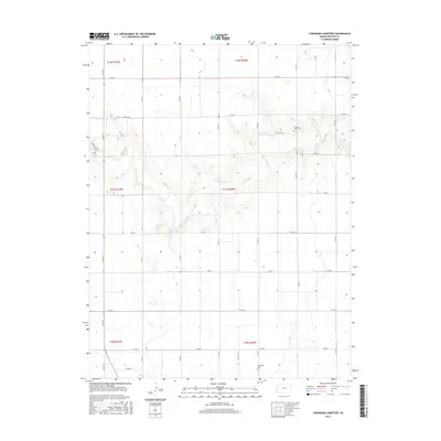
2015 Map of Coronado Cemetery
USGS Topo · Published 2015About this map
The high plains of western Kansas characterize this area of Wichita County, where a strictly rectangular grid of section lines and gravel roads dictates the movement across the landscape. Grounded in the tradition of rural burial sites, Coronado Cem and Pleasant Valley Cem serve as critical historical anchors for genealogists tracing early families in the region. The terrain is marked by subtle drainage patterns and depressions that break the flat horizon, with the road network including major local routes like N 4th St and Indian Rd. These thoroughfares, along with lettered roads such as Co Rd G and Co Rd H, provide a detailed look at the rural infrastructure of Leoti Township during the mid-2010s. The map illustrates how township and range boundaries, including t17s r36w and t16s r37w, organize the vast agricultural parcels that define this part of the Kansas wheat belt.
Find a feature on this map
27 named features on this map. Tap any name to fly to it.
Don’t see what you’re looking for? This feature index may not catch every label — zoom into the map to look around manually.
Map Details
Editions of this 2015 Coronado Cemetery Map
This is the sole edition of this map. No revisions or reprints were ever made.
Other maps of this area

1939 · Pence
USGS Topo · 1:62,500

1941 · Modoc
USGS Topo · 1:62,500

1941 · Pence
USGS Topo · 1:62,500

1951 · Modoc
USGS Topo · 1:62,500

1955 · Scott City
USGS Topo · 1:250,000

1958 · Scott City
USGS Topo · 1:250,000

1968 · Russell Springs 3 SW
USGS Topo · 1:24,000

1968 · Russell Springs 3 NW
USGS Topo · 1:24,000

1968 · Russell Springs 3 SE
USGS Topo · 1:24,000

1968 · Russell Springs 3 NE
USGS Topo · 1:24,000