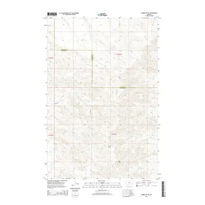
2014 Map of Corral Butte
USGS Topo · Published 2014About this map
Corral Butte and Big Peak dominate this landscape along the border of Prairie and Custer counties. This 2014 survey documents a high-plains terrain defined by a complex network of drainage systems, including Prairie Cr, Miles Cr, and Williams Cr. The map reveals the intricate natural topography of eastern Montana, where numerous seasonal waterways such as Corral Cr, Cottonwood Cr, and Schlosser Cr have carved the land. Aside from Frontage Rd in the southwest, the area remains largely undeveloped, showcasing the vast open spaces characteristic of the region’s ranching country. The absence of towns or dense infrastructure highlights the rural nature of this portion of the Yellowstone River watershed, providing a clear view of the land's natural contours and water courses.
Find a feature on this map
22 named features on this map. Tap any name to fly to it.
Don’t see what you’re looking for? This feature index may not catch every label — zoom into the map to look around manually.
Map Details
Editions of this 2014 Corral Butte Map
This is the sole edition of this map. No revisions or reprints were ever made.
Other maps of this area

1953 · Miles City
USGS Topo · 1:250,000

1957 · Miles City
USGS Topo · 1:250,000

1958 · Miles City
USGS Topo · 1:250,000

1969 · Corral Butte
USGS Topo · 1:24,000

1969 · Spring Draw
USGS Topo · 1:24,000

1969 · Zero NE
USGS Topo · 1:24,000

1969 · Zero
USGS Topo · 1:24,000

1969 · Kinsey NE
USGS Topo · 1:24,000

1969 · The Knob
USGS Topo · 1:24,000

1969 · Buck Mountain
USGS Topo · 1:24,000