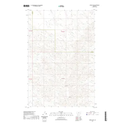
2020 Map of Corral Butte
USGS Topo · Published 2020About this map
Corral Butte and Big Peak dominate the high ground of this Eastern Montana landscape, marking a prominent divide in the drainages of Prairie and Custer counties. The terrain is defined by an intricate network of coulees and intermittent streams, where Miles Cr and Prairie Cr weave through the complex topography of the t9n r50e and t10n r50e townships. This area reflects the characteristic open-range drainage patterns of the region, with watercourses like Cottonwood Cr, Schlosser Cr, and Maggie Cr carving out the landscape's deep contours. The map captures a moment in the modern era of land management, illustrating the precise Public Land Survey System boundaries that define ranching and grazing tracts across this part of the state.
Find a feature on this map
22 named features on this map. Tap any name to fly to it.
Don’t see what you’re looking for? This feature index may not catch every label — zoom into the map to look around manually.
Map Details
Editions of this 2020 Corral Butte Map
This is the sole edition of this map. No revisions or reprints were ever made.
Other maps of this area

1953 · Miles City
USGS Topo · 1:250,000

1957 · Miles City
USGS Topo · 1:250,000

1958 · Miles City
USGS Topo · 1:250,000

1969 · Corral Butte
USGS Topo · 1:24,000

1969 · Spring Draw
USGS Topo · 1:24,000

1969 · Zero NE
USGS Topo · 1:24,000

1969 · Zero
USGS Topo · 1:24,000

1969 · Kinsey NE
USGS Topo · 1:24,000

1969 · The Knob
USGS Topo · 1:24,000

1969 · Buck Mountain
USGS Topo · 1:24,000