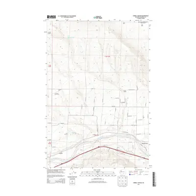
2013 Map of Corral Canyon
USGS Topo · Published 2013About this map
Benton City serves as a focal point in the lower right of this survey, where the Yakima River winds through the landscape. This area is defined by its water management and agricultural infrastructure, evidenced by the presence of the Kiona Canal and various springs like Katie Fleck Spring and Lonesome Spring that punctuate the higher elevations. North of the river, the terrain rises into the Rattlesnake Hills Research Natural Area and Iowa Flats, showcasing the transition from irrigated valley land to the high desert plateaus of eastern Washington.
Find a feature on this map
58 named features on this map. Tap any name to fly to it.
Don’t see what you’re looking for? This feature index may not catch every label — zoom into the map to look around manually.
Map Details
Editions of this 2013 Corral Canyon Map
This is the sole edition of this map. No revisions or reprints were ever made.
Other maps of this area

1915 · Prosser
USGS Topo · 1:125,000

1917 · Pasco
USGS Topo · 1:125,000

1917 · Prosser
USGS Topo · 1:125,000

1951 · Richland
USGS Topo · 1:62,500

1951 · Corral Canyon
USGS Topo · 1:62,500

1953 · Walla Walla
USGS Topo · 1:250,000

1958 · Walla Walla
USGS Topo · 1:250,000

1965 · Whitstran
USGS Topo · 1:62,500
1965 · Weber Canyon
USGS Topo · 1:24,000
1965 · Whitstran
USGS Topo · 1:24,000