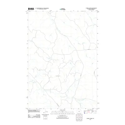
2012 Map of Corral Creek
USGS Topo · Published 2012About this map
Sandbar West Oil Field stands as a central industrial feature in this part of Campbell County, where energy extraction meets an intricate network of drainage basins. The landscape is defined by the headwaters and prongs of several desert waterways, including the winding Buffalo Cr and the extensive Armstrong Prong Bitter Cr. These seasonal streams dictate the orientation of local ranch roads like Weischedel Rd and Beason Rd, which navigate the elevation changes between Corral Cr and Olmstead Cr. The presence of Bitter Creek Rd alongside its namesake Bitter Cr illustrates the historical reliance on these drainages for establishing travel corridors through the Wyoming basin. This map documents a modern era of resource development while preserving the original hydrographic nomenclature of the high plains.
Find a feature on this map
13 named features on this map. Tap any name to fly to it.
Don’t see what you’re looking for? This feature index may not catch every label — zoom into the map to look around manually.
Map Details
Editions of this 2012 Corral Creek Map
This is the sole edition of this map. No revisions or reprints were ever made.
Other maps of this area

1954 · Ekalaka
USGS Topo · 1:250,000

1954 · Gillette
USGS Topo · 1:250,000

1955 · Gillette
USGS Topo · 1:250,000

1956 · Ekalaka
USGS Topo · 1:250,000

1958 · Gillette
USGS Topo · 1:250,000

1958 · Ekalaka
USGS Topo · 1:250,000

1962 · Gillette
USGS Topo · 1:250,000

1965 · Ekalaka
USGS Topo · 1:250,000

1970 · Moorhead
USGS Topo · 1:24,000
1970 · Bay Horse
USGS Topo · 1:24,000