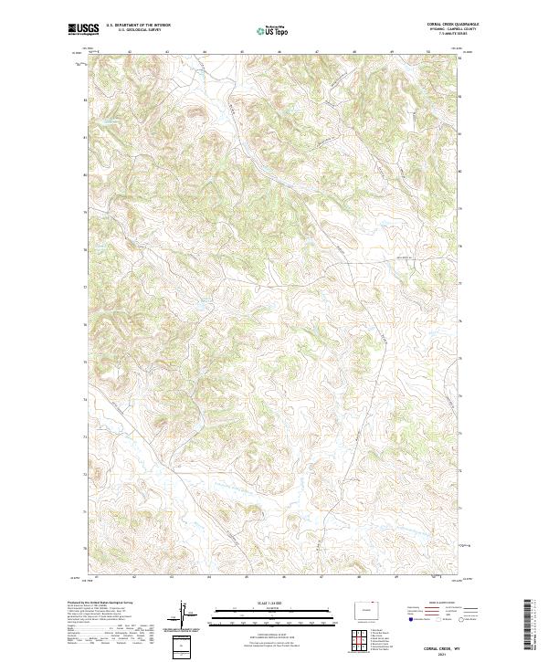
2021 Map of Corral Creek
USGS Topo · Published 2021About this map
Corral Creek and its numerous tributaries define this corner of Campbell County, where the high plains terrain is carved by complex drainage systems like Armstrong Prong Bitter Cr and Buffalo Cr. The landscape is notably punctuated by a series of small water catchments, including J D Reservoir, Fox Farm Reservoir, and Eaton Reservoir, which suggest a localized history of ranching and water management. Modern land use and access are reflected in the road names, which range from the utilitarian Bitter Creek Rd and Beason Rd to more evocative residential and recreational labels such as Rawhide Gorge Trl and Buck Skin Canyon Cir. The intricate contouring reveals a highly dissected topography where ephemeral streams like Dry Cr have etched deep into the Wyoming soil.
Find a feature on this map
25 named features on this map. Tap any name to fly to it.
Don’t see what you’re looking for? This feature index may not catch every label — zoom into the map to look around manually.
Map Details
Editions of this 2021 Corral Creek Map
This is the sole edition of this map. No revisions or reprints were ever made.
Other maps of this area

1954 · Ekalaka
USGS Topo · 1:250,000

1954 · Gillette
USGS Topo · 1:250,000

1955 · Gillette
USGS Topo · 1:250,000

1956 · Ekalaka
USGS Topo · 1:250,000

1958 · Gillette
USGS Topo · 1:250,000

1958 · Ekalaka
USGS Topo · 1:250,000

1962 · Gillette
USGS Topo · 1:250,000

1965 · Ekalaka
USGS Topo · 1:250,000

1970 · Moorhead
USGS Topo · 1:24,000
1970 · Bay Horse
USGS Topo · 1:24,000